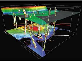
Geophysical Interpretation
Using Seisvision 2D/3D, we work in an integrated seismic time and depth interpretation system. We deliver a full range of interpretation, analysis, and mapping tools for developing high-quality prospects with presentation quality maps.
Our integrated geophysical interpretation capabilities let you:
- interactively manage horizons and faults
- multiple attribute analysis
- a wide range of quick-look and presentation quality mapping
- depth conversion
- tie seismic and welldata using a fully-integrated synthetic application
- datum elevation and velocity for time-structural models
- display synthetics and seismic trace data in depth and time
- easily load and integrate 2D & 3D data